
Written by Hwa-Ching Lin, Chih-Chin Shih, Hsiao-Tien Hsieh, and Chia-Tzu Chen
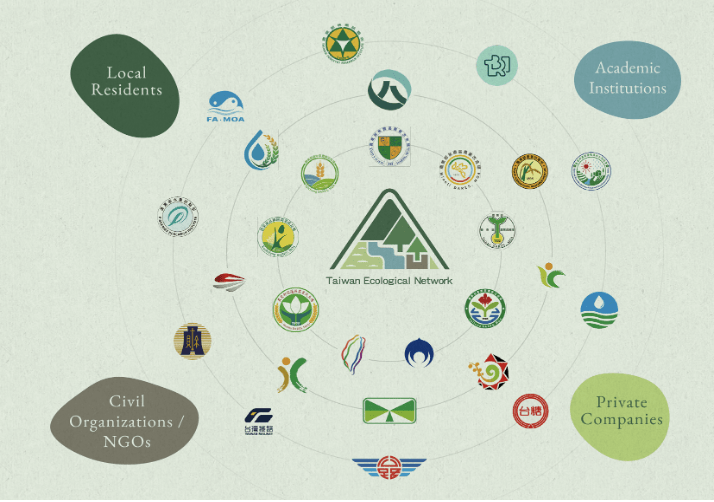
Image credit: Forestry and Nature Conservation Agency. Multi-stakeholder collaboration and cross-sectoral partnerships are central to each element of the Taiwan Ecological Network.
Introduction.
Taiwan sits at the convergence of the Eurasian and Philippine Sea plates, where tropical and subtropical zones meet. Despite its compact size of just 36,000 square kilometres, the island boasts more than 200 mountains exceeding 3,000 meters in elevation. This sharp altitudinal gradient has given rise to a rich variety of ecosystems. Over 60,000 species have been recorded on the island—about 3.4% of the world’s known species—with endemics making up nearly a quarter, underscoring Taiwan’s exceptional richness as a global biodiversity hotspot.
Though densely populated, Taiwan maintains a close relationship between people and nature. The Central Mountain Range forms the island’s ecological backbone, with river systems branching across a gradient of habitats and landscapes, from high-altitude forests to coastal wetlands. These include primary forests, mid-elevation satoyama villages, expansive lowland farmlands, and estuarine ecosystems. Together, they form a diverse and vibrant “forest–river–village–ocean” landscape–seascape, representing shared natural assets whose ecosystem services are essential to public safety, human well-being, and sustainable economic development. This article explores how Taiwan’s conservation vision has broadened from isolated reserves to an island-wide ecological network. Through data-driven planning, nature-based strategies, and cross-sector cooperation, the governance model seeks not only to protect biodiversity but also to weave it into everyday landscapes and livelihoods.
Conservation Networks: From Protected Areas and State-owned Forests to the Shallow Mountain Plains.
Taiwan’s legally designated protected areas currently encompass nearly one-fifth of the island’s terrestrial area, forming the backbone of the Central Mountain Range Conservation Corridor. Surrounding these reserves are state-owned forest areas, which are strictly managed and account for 42.5% of the land area (see Fig. 1). These forests focus on conserving and sustainably using forest resources and are managed through rational zoning and operations that create a flexible protection mechanism. In addition to safeguarding forests and biodiversity, they serve as key buffer zones and sustainable-use areas around the core corridor, further enhancing the stability and resilience of Taiwan’s ecosystems.

Outside Taiwan’s national forests, the foothills, farmlands, plains, and coastal zones are closely intertwined with densely populated urban environments. While these areas are central to human settlement and economic activity, they also provide critical habitats for more than half of the island’s protected wildlife and Red List plant species. However, rapid urbanisation and industrial expansion have intensified land use and fragmented natural landscapes, leading to habitat loss and ecological degradation. These pressures not only endanger the survival of lowland species but also compromise the integrity of ecosystem services essential to human well-being.
Since 2009, the Taiwan Government has promoted the restoration of key farmland ecosystems, followed in 2010 by the adoption of the Satoyama Initiative. Building on the foundation of Community Forestry, these efforts have guided rural communities rich in biodiversity toward the sustainable management of natural resources. In 2018, the government formally launched the Taiwan Ecological Network (TEN), a nationwide initiative aimed at restoring and reconnecting diverse ecological habitats across forests, rivers, villages, and coastal zones. The program seeks to enhance ecosystem services and social-ecological resilience through a more integrated and forward-looking spatial strategy, combining national-level planning with localised governance tools. By implementing nature-based solutions (NbS), TEN embeds conservation actions within broader ecological, social, and economic contexts, creating new opportunities for the “whole of government, whole of society” biodiversity conservation in lowland areas.
Spatial Planning Informed by Biodiversity Data.
TEN has been developed through a comprehensive analysis of the nationwide biodiversity data. By integrating spatial layers such as biodiversity hotspots, endangered species distributions, satoyama landscapes, and land-use patterns, the program identifies the key areas for the conservation of biodiversity and ecosystem services. In 2020, TEN completed the delineation of eight regional planning units and 44 priority biodiversity areas across Taiwan. Building on this foundation, in 2023, 45 conservation corridors were designated based on the urgency of habitat restoration and connectivity (see Fig. 2). These corridors were categorised into five major habitat types: shallow mountain, stream, valley, coastal, and offshore island.

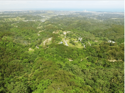
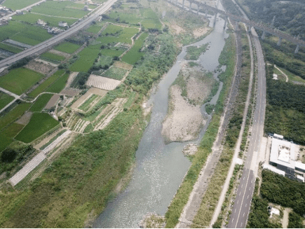
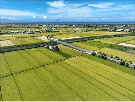
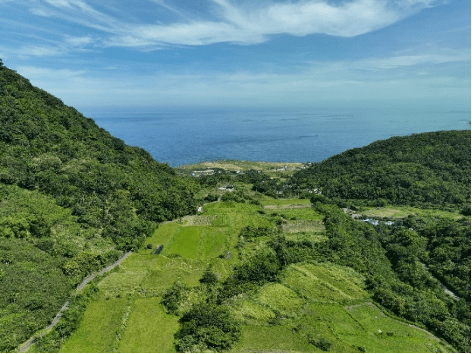
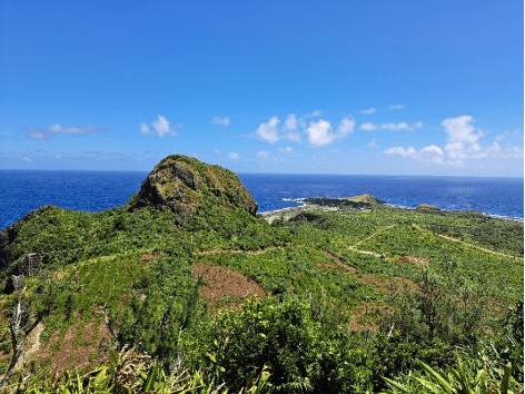
The designated conservation corridors encompass a far broader landscape, categorised into five major habitat types (Fig. 3-7). Shallow-mountain corridors span foothill forests, tablelands, and farmlands, using eco-friendly farming, vegetation restoration, slope and waterway improvements, and wildlife crossings to reinforce connectivity and resilience. Stream corridors trace major rivers and tributaries, focusing on better in-stream structures, restored floodplains, and unimpeded migratory routes within whole-watershed planning. Valley corridors occupy lowland agro-wetland mosaics, integrating upgraded irrigation, pond and spring restoration, and community-led habitat management. Coastal corridors unite coastal forests, estuaries, and tidal wetlands, where wetland restoration, coastal forest belts, eco-friendly livelihoods, and education enhance community resilience. Offshore-island corridors on Kinmen, Matsu, Penghu, Green, and Orchid Islands prioritise Eurasian otter and Formosan flying fox protection, road-kill reduction, and restoration of native vegetation and cultural scenery.
TEN’s spatial database transforms complex ecological information into actionable spatial data, serving as a critical bridge between policy development and on-the-ground implementation. In addition to identifying the distribution and connectivity potential of key habitats across Taiwan, it provides clear guidance for government agencies, infrastructure planners, local communities, and businesses in land-use planning, habitat restoration, infrastructure adjustments, and ESG-related initiatives. The application of this spatial data enhances stakeholder awareness and responsiveness to ecologically sensitive areas, facilitates the implementation of NbS, and functions as a core tool for advancing habitat connectivity, biodiversity conservation, and sustainable development.
Cross-sectoral Collaboration to Advance Integrated Nature-based Strategies.
Since its launch in 2018, TEN has completed the spatial planning blueprint, data inventory, and restoration of key habitats and laid the foundation for cross-sectoral and cross-ministerial collaboration and strong public support. From 2026 onward, TEN will be further oriented towards integrated and evidence-based governance, strengthened institutional operation, and scientific decision-making. These efforts will also include a close alignment with the Kunming-Montreal Global Biodiversity Framework and working towards transformative conservation governance by 2030.
Over the past seven years, TEN has developed a wide array of ecosystem-based approaches to address various social, economic, and environmental challenges. Building on this experience, TEN will continue promoting such strategies as habitat restoration, species conservation, resource management, data sharing, and public participation to support practical habitat recovery and stewardship.
To ensure the effective implementation of these strategies, trust is fundamental to advancing cross-sectoral collaboration. TEN has established eight regional platforms across Taiwan to respond to local environmental and conservation needs. These platforms bring together policy tools and resources from various agencies to co-develop governance strategies tailored to regional contexts. They also foster long-term dialogue and cooperation among central and local governments, the public and private sectors, academia, and communities—gradually building trust through collaborative practice.
By setting shared goals, exchanging ecological data, and co-implementing projects, TEN’s regional platforms strengthen mutual understanding and shared responsibility. These efforts not only enhance horizontal policy integration and vertical coordination but also convert growing consensus into measurable outcomes and stronger public backing—laying a durable foundation for inclusive, nationwide participation in protecting both nature and human well-being.

Towards Sustainable Taiwan: Living in Harmony with Nature.
From transportation networks and river basins to agricultural lands and urban areas, reconnecting and restoring critical habitats is essential to maintaining stable and functional ecosystem services. A healthy environment forms the foundation for sustainable development. Through a scientific and systematic data-driven approach, TEN offers a clear strategic blueprint for national conservation planning. By integrating NbS as a key means of implementation, TEN supports efforts ranging from biodiversity conservation to sustainable use. It enables stakeholders to pursue a broader, long-term perspective that balances development and conservation—ensuring that land is used appropriately and sustainably. In doing so, Taiwan moves toward a future where production, daily life, and ecological integrity are aligned, allowing people and nature to coexist in harmony, from forests to the coast.
Hwa-Ching Lin serves as the Director General of the Forestry and Nature Conservation Agency of Taiwan. He has a longstanding interest in human-wildlife interactions. He is currently promoting the integration of socio-ecological production landscapes and seascapes, as well as Indigenous and local issues, into forestry and biodiversity policies.
Chih-Chin Shih, a senior specialist at the Forestry and Nature Conservation Agency of Taiwan, is committed to promoting the Taiwan Ecological Network and effectively utilising biodiversity data for policy-making and spatial planning.
Hsiao-Tien Hsieh works as the section chief of the Forestry and Nature Conservation Agency Taiwan. She has a major in natural resource management and has been engaged in the Taiwan Ecological Network and spatial planning.
Chia-Tzu Chen works as a specialist at the Forestry and Nature Conservation Agency Taiwan. She specialises in environmental economics and has been engaged with the Taiwan Ecological Network and the evaluation of ecosystem service values.
This article was published as part of a special issue on ‘Co-Weaving Taiwan Ecological Network: Satoyama in Practice‘.
