
Written by Sra Manpo Ciwidian.
Image credit: P1530216 by yanxi/ Flickr, license: CC BY-NC 2.0.
Throughout history, the land issue has consistently been one of the critical and pivotal concerns for the Indigenous peoples of Taiwan in our pursuit to reclaim our inherent rights. Concurrently, it has contributed to friction and conflicts between Indigenous communities and the government.
To assert Indigenous sovereignty over our land, especially the traditional territories, the Indigenous peoples of Taiwan have employed various approaches to demonstrate our rights. Making a three-dimensional map model of Indigenous communities is one of the most prevalent among these approaches. Since the late 1990s, when the Kucapungane community of Rukai people produced the first Indigenous 3D map model in Taiwan, contemporary Indigenous communities in Taiwan have been developing this community-based mapping method for over three decades.
In the aftermath of the year 2000, the Council of Indigenous Peoples, Taiwan, had successively tasked academic institutions to conduct a series of “Indigenous Traditional Territory Survey.” Notwithstanding the controversies and criticisms surrounding these investigations’ procedural aspects and findings, many Indigenous communities have been involved in official traditional territory surveys or have taken the initiative to conduct their own investigations and produce 3D community models. The engagement of Indigenous communities in participatory 3D modelling (P3DM) can be regarded not only as a bottom-up approach to convey Indigenous history, knowledge, and our intimate relationship connection with the land but also as a tangible endeavour to advance Indigenous resurgence.
A Pathway for Re-establishing Connection with Our Communities
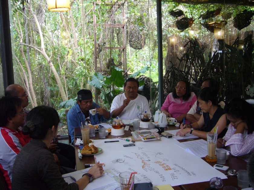
In the early 2010s, I had the valuable opportunity to learn the methodology of P3DM through my limited engagement in Indigenous land research under my master’s advisor Daya Dakasi, which subsequently allowed me to have the privilege to participate in and contribute to the production of 3D map models for numerous Indigenous communities, including my own. For someone like me, as an Indigenous individual who spent much of my formative years in urban areas, engaging in the P3DM has opened a pathway for me and other diasporic Indigenous youth to (re)establish a connection with our communities. It has also empowered Indigenous youth to reflect on and (re)envision our own relationship with the land, thereby influencing our identity’s (re)shaping.
Indigenous participatory 3D mapping is considered a means by which contemporary Indigenous peoples of Taiwan have perpetuated and passed down Indigenous knowledge to future generations, while its outcomes have functioned as a mediator and educational tool carrying Indigenous languages and Indigenous knowledge. Furthermore, the introduction of innovative technologies used to make 3D community models, coupled with the formulation of mapping agendas and procedural arrangements, has also created spaces for elders and community members to not only jointly share and discuss Indigenous knowledge pertaining to the land but also enhance their comprehension of the predicaments and challenges that Indigenous land issue confronts in the contemporary society. In other words, this bottom-up and community-based approach of Indigenous mapping serves as an ongoing process that continually fosters consensus-building among community members.
Out of all my engagements in community 3D map projects, the experience in Makota’ay community, a Pangcah Indigenous community situated in Fengbin Township, Hualien County, in 2012 remains vivid in my mind. Before embarking on the actual mapmaking process, the middle-aged community members, who have actively engaged in and shown concern for community development issues, organised a meeting and invited numerous elders to participate. In that meeting, the younger generation assisted the elders in employing Google Earth to discern the landscapes and geological features. Then it proceeded to mark the Indigenous place names on Google Earth. What impressed me deeply was the elders’ ability to learn GIS, their use of the Indigenous language to elucidate the origins and meanings of each place name, and their remarkable capacity to strive for consensus in the face of diverging viewpoints on the meaning of place names.
Storytelling from the Elders and the Lands
Indigenous place names embody the collective memories of Indigenous communities and reflect the Pangcah’s cosmological and epistemological perspective on the geological characteristics of the land and the sustainable governance of natural resources. Therefore, as I and other young participants listened to the elders explaining the place names, it felt like the land was speaking. I truly felt a deepened and intimate connection with the land at that moment. Mountains embodied more than merely geographic and topographic significance, while rivers embodied more than mere flowing streams. Each was bestowed with a name, symbolising the community history, Indigenous knowledge, and the interconnections between our people and the land.
It is worth noting that many communities went beyond simply displaying the maps in a designated space after completing the mapping process. They further developed proactive and dynamic initiatives to familiarise community members with their traditional territories. Taking my own community, Angcoh, as an example, during the initial traditional territory investigation, a group of young partners and I learned from the elders about an ancient trail on the mountain behind our community, connecting Yuli Township in Hualien County and Changbin Township in Taitung County in the past. The elders emphasised the profound significance of the ancient trail for our community that it went beyond being a mere route for people’s movement or trade; it served as a vital pathway for maintaining strong relationships with other communities on the other side of the mountain, especially for the ilisin (often translated as harvest festival).
Traditionally, before the annual ilisin, it was customary for Pangcah communities located on both sides of the mountains to dispatch young representatives on a challenging journey through mountains and the ancient trail to reach allied communities. Their mission was to inform and invite allied communities to attend the ilisin. In the Pangcah language spoken in my community, we use the term “mikarong” to refer to these visits and actions. However, with the advent of telecommunication systems, postal networks, and the construction of the Yuli-Changbin Highway, the reciprocal interaction between the two sides waned over time.
Upon learning of these profound collective memories from the elders, my companions and I envisioned retracing the steps of our ancestors on this ancient trail prior to the annual ilisin, actively perpetuating this cultural practice. Fortunately, through years of effort and communication with the chief and elders, around the mid-2010s, our community tribe successfully revitalised the “mikarong” and resumed sending people to cross the ancient trail to invite neighbouring communities to attend our ilisin. This endeavour contributes to guiding the youth to develop a deeper intimate connection to the community, culture, and our own identity while perpetuating Indigenous knowledge of the land and fostering sustainable relationships with our allied communities.
P3DM as an Indigenous Storytelling Practise
Land is alive, vibrant, and always evolving. Indigenous peoples of Taiwan have recontextualised and transformed the method of P3DM into an Indigenous storytelling practice to illustrate the land histories as well as their relationship with the land in today’s world. A 3D community model extends beyond its physical form per se; it tells the stories of contemporary Indigenous life experiences, our resilience in resisting colonisation within this settler country, and our demonstration of Indigenous sovereignty over the land that predates the state. It serves as a tangible practice to advance Indigenous resurgence.
However, participants must comprehensively understand the dynamic nature of traditional territories, as this is an additional essential aspect of Indigenous mapping. Indigenous mapping is not aimed at rigidifying or demarcating a clearly defined boundary of traditional territories through maps but rather at recognising the variability of these boundaries. This, in turn, can inspire us to reflect on the governance of Indigenous lands and natural resources in the contemporary era, the delineation of traditional territories, and the pursuit of greater possibilities for self-determination.
Acknowledgement
I want to express my heartfelt condolences and pay tribute to the late Dr Lin Shu-ya, who passed away in the recent MRT accident in Taichung. Her teachings and guidance have deeply influenced a significant part of my learning and application of P3DM techniques and knowledge. I am profoundly grateful for her inspiration at the time and her remarkable contributions and unwavering dedication to advancing Indigenous rights. May she find eternal peace, and her legacy will be forever cherished and honoured by the Indigenous peoples of Taiwan.
Sra Manpo Ciwidian is a PhD student in the Department of Political Science, University of Hawaiʻi at Mānoa. He can be reached at sramanpo@hawaii.edu.
This article was published as part of a special issue on Indigenous storytelling in Taiwan.
